Overview
-
Status
Ongoing -
Estimated Completion
2024 -
Location
Cochiti Lake, New Mexico -
Grants Received
$90,000 -
Friends Group
Sun Country Outdoors -
Partners
Cochiti Pueblo, U.S. Army Corps of Engineers, New Mexico Game and Fish, New Mexico Bass Nation, Rinker Materials, Jaynes Construction/NM Carpenters Union, New Mexico Wildlife Federation
Cochiti Reservoir, spanning approximately 1,200 acres with a depth of about 100 feet, has historically supported a diverse range of fish species. This reservoir plays a crucial role in flood control, irrigation, recreation, and wildlife habitat. Over the years, it has become an essential habitat for various fish species, including bass, catfish, and trout. Cochiti Reservoir draws recreational anglers from hundreds of miles around and has become one of the most popular fisheries in the state due to its proximity to Albuquerque and Santa Fe. In addition, it provides angling and outdoor opportunities to the Cochiti Pueblo, whose tribal lands surround the reservoir.
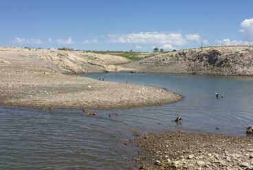
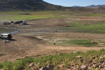
However, due to factors such as fluctuating water levels, sedimentation, and limited structural diversity, the fish habitats within the reservoir have faced significant challenges. Like many Western reservoirs, Cochiti Reservoir undergoes wide fluctuations in water elevation within a single year and across years, and its aquatic community must tolerate extreme drought and flood conditions. This water regime is not only stressful to biota, but also detrimental for the durability of physical fish habitat structures and plants. In addition, this stressful environment tends to provide an invasion opportunity to non-native species, including noxious plants like Eurasian water milfoil.
Why It Matters
The Cochiti Dam site lies just downstream of the mouth of White Rock Canyon, which marks the beginning of the Middle Valley of the Rio Grande. Downstream from the project area, the Rio Grande flows into a fertile river valley characterized by a narrow riparian woodland of cottonwood trees, cultivated farms, Indian Pueblos, small towns, and expanding metropolises.
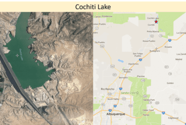
Cochiti Reservoir is an important fishery in New Mexico due to its proximity to the largest population centers in the state. It is located on the picturesque eastern base of the Jemez Mountains, where a series of wooded mesas, foothills, potreros, and narrow canyons descend to meet the Rio Grande. Our reservoir is located in Sandoval County, New Mexico, upstream from the Pueblo de Cochiti, about 50 miles north of Albuquerque and 20 miles southwest of Santa Fe, New Mexico. It is the closest thing New Mexico has to an urban fishery in the most highly populated area of the state.
Construction and operation of Cochiti Dam was authorized under the Flood Control Act of 1960 and PL 86-645, PL 534 as amended, Senate Document No. 97, and PL 88-293. Cochiti Dam is authorized to regulate Rio Grande flows for flood and sediment control. The facility is constructed on Pueblo de Cochiti Land and was designed, built, and is operated by the U.S. Army Corps of Engineers to reduce flooding downstream from the dam. Construction of the dam began in 1965 and impoundment of water in Cochiti Lake began in 1973.
Total construction cost was $94.4 million, but it is estimated that the dam saved over $113 million in flood damages in 2013 alone. Economic benefits of Cochiti Lake range from $1 to 7 million annually, drawing about 200,000 visitors per year. In addition, the reservoir serves an essential role in flood control for the Rio Grande and provides drinking water to the City of Albuquerque.
In addition to flood damage reduction, sediment control, and recreation, the lake also serves as a drinking water supply for the city of Albuquerque as well as fish and wildlife habitat. The lake has two public recreation areas both with shoreline access for fishing and swimming and picnic shelters The Cochiti Recreation Area is located on the west side of the lake hosts a maintained hiking trail, a regulated swim beach, an overlook, a picnic area, a boat ramp, and a USACE managed campground. The Tetilla Peak Recreation Area is located on the east side of the lake and contains seven recreation areas with shoreline access, a boat ramp, and a USACE managed campground.
The project significantly benefits the local community by enhancing recreational fishing opportunities, which in turn boosts local tourism and the economy. Improved fish habitats also contribute to a healthier ecosystem, supporting biodiversity and providing educational and recreational benefits to residents and visitors alike. Community involvement in the project fosters a sense of stewardship and conservation awareness among the local population. As demonstrated by the most recent project at Cochiti Reservoir, a wide variety of partners are coming together to improve the reservoir’s fish habitat, including Tribal partners, state and Federal partners, local angling groups, and local businesses.
Threats
The Cochiti Lake Aquatic Habitat Enhancement Project addresses several habitat needs of Cochiti Lake. The Rio Grande in the project area is normally turbid and the bottom very unstable and flows at the dam site typically range from 7,000 second-feet(cfs) in the spring to about 200 second-feet (cfs) in the fall. Runoff from the steep mountains and foothills of the watershed is rapid until it reaches the relatively flat areas in the river valleys. In recent years, harmful algal blooms (HABs) have been documented in Cochiti Lake. Severe wildfires in the adjacent Jemez mountains have exacerbated and accelerated the rate of sediment deposition and cove siltation in Cochiti Lake. Over 8 miles of prime spawning shoreline has been destroyed and an additional one to two miles of spawning habitat is lost each year. The additional sedimentation and local erosion has also led to aggressive invasion of Eurasian watermilfoil, choking out native aquatic plant species.
An initial survey of Cochiti Reservoir in early July 2020 showed that Eurasian water milfoil (EWM) has developed an almost continuous submerged presence from approximately 10 feet to 2 feet in depth around the perimeter of the reservoir. In some cases, the beds are over 100 feet wide and exist as monotypic, thick stands. Thick patches exist near the swimming area and the popular east side coves where they could become a swimming hazard. The encroachment has negatively impacting biodiversity in the reservoir. While Cochiti Lake supports a number of native aquatic and wetland species, these desirable plants are eclipsed in abundance and distribution by the EWM.
Work is currently underway developing nutrient monitoring plans to evaluate upstream and downstream environments of the reservoir and within active HABs areas. It is unclear at this time how the presence of native or invasive aquatic plants may effect nutrient cycling within the reservoir or how this influences HABs outside of other autochthonous (legacy nutrients in lake sediments) or allochthonous (disturbance within the watershed – e.g. post-fire erosion and subsequent sedimentation within the reservoir, or operational releases for flood control) sources of nutrients that may be contributors in the system.
The 11,147-acre lake is considered eutrophic and is about 20 miles long at maximum flood control pool. The permanent pool extends about 7 miles upstream of the dam and has an approximate surface area of 1,240 acres. There is approximately 21 miles of shoreline at the permanent pool elevation; however, a substantial portion of the shoreline is not accessible because of the rugged terrain and steep canyon walls. Also an unresolved impairment is the clearcutting and leveling of the entire area near the earthen dam. The barren coves have almost no structure nor vegetation except the Eurasian watermilfoil.
What FOR is Doing
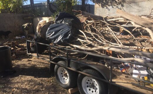
The Cochiti Reservoir Fish Habitat Improvement Projects aim to enhance the structural complexity of the aquatic environment, improve spawning and feeding grounds for key fish species, and promote the overall health and diversity of fish populations. These efforts are essential to sustain the ecological balance and recreational fishing opportunities in the reservoir.
A $50,000 FY22 NFHP Grant was awarded, and work is still ongoing. This grant is directed towards the propagation of native aquatic and shoreline vegetation and fish habitat placement with an emphasis on spawning enhancement for both game and forage fish species.
A $40,000 FY25 NFHP Grant, which is considered to be a Cochiti Pueblo project (tribal project), has been forwarded to the NFHP Board for funding. This phase of the project will fully implement greenhouse modifications, aquatic and riparian plant nursery upgrades and re-vegetation efforts led by the Cochiti Pueblo in partnership with Sun Country Outdoors and the US Army Corps of Engineers. The project will improve native aquatic plant propagation capabilities at the Cochiti Pueblo.
The greenhouse propagation facility, located on tribal land, will propagate plants for both the Desert Fish Habitat Partnership and the Reservoir Fish Habitat Partnership.
Re-establishing native plant species in Cochiti Reservoir yields numerous benefits: 1) expansion of the physical structure needed by fish for cover and foraging, 2) replacement of noxious species such as Eurasian water milfoil which provide lower quality fish habitat, 3) potential buildup of a natural seedbank for plant expansion during favorable growing years, 4) stabilization of the sediment and shoreline, and 5) provision of more usable areas for anglers and boaters.
More about the Original RFHP Grant
This project addresses several impairments on Cochiti Lake, New Mexico: sedimentation, aquatic invasive species and initial vegetation removal and earth scouring during dam construction. The lake has also been subject to hazardous algae blooms. This grant will be directed towards the propagation of native aquatic and shoreline vegetation and fish habitat placement with an emphasis on spawning enhancement for both game and forage fish species.
The major objectives of the project are: 1) To improve and revitalize degraded aquatic habitat and enhance local aquatic communities through aquatic invasive species removal, 2) improve aquatic habitat by stabilizing eroded shorelines and improving bank shading through native vegetation establishment and management, 3) create spawning and production fish habitat by deploying fish habitat structures adjacent to restoration sites, channels, and barren construction scars, 4) enhance spawning sites for prey-base species including gizzard shad and yellow perch. 5) increase angler use of fish habitat sites (boat and shoreline anglers) to increase awareness and support, and 6) increase angler/user and public knowledge about the value and benefit of a healthy reservoir ecosystem through project outreach events and media coverage. While it is not explicitly an objective of this project, there is reason to believe that success with the project will also reduce the excess nutrients that lead to hazardous algae blooms.
This project grant will support continuation of a project that has begun with a thorough evaluation of the reservoir, documentation of sedimentation and Eurasian watermilfoil impairments, options for water manipulation, and reviews of multiple fish electroshocking surveys. The project is currently constructing an on-site greenhouse for propagation of native aquatic plants to be used as part of an extensive AIS eradication and replacement strategy funded by the Corps, partners and an AFTCO grant.
This grant will be directed towards the following methods:
- construction and placement of specifically designed or selected fish habitat with an emphasis on spawning enhancement for both game and prey-base species,
- continue efforts to eradicate the Eurasian watermilfoil and replace it with native vegetation, and
- increase public user interest and satisfaction through education, participation and enhanced angling opportunities with an emphasis on youth involvement.
The reservoir lacks elements of fish habitat in most areas of the lake but has specific needs for both gamefish and forage fish in specific areas near the dam construction area. A combination of commercial fish habitat and attractors will be used along with repurposed pipe culverts, constructed reef balls and a variety of do-it-yourself designs constructed and deployed by volunteers and partners. A large amount of natural driftwood will also be used for spawning benches as a continuation of earlier pilot-scale efforts.
Control of the aquatic invasive species Eurasian watermilfoil will have a positive impact on biodiversity and aid in restoring a healthy aquatic ecosystem, as well as, preventing the contribution of nutrients aiding in harmful algal blooms. Native aquatic vegetation plantings grown in an onsite nursery will have higher success rates and will help keep limnetic zones intact, reduce shoreline loss and turbidity, contribute to juvenile fish habitat, and aid in excess nutrient uptake. Revegetation with native aquatic and shoreline plant species, based on several prior RFHP project best practices, will contribute to bank shading of the littoral zone, an established climate change strategy, and improving fish habitat. Examples of local native species are smartweed, coyote willows, Goodding’s willows, Rio Grande and Fremont cottonwoods and native pondweed. Submerged artificial fish habitat structures (concrete culvert pipes, concrete reef balls and plastic fish habitat structures) will provide long-lasting fish and macroinvertebrate habitat in areas that have none. The stabilized shoreline resulting from vegetation plantings will reduce nearshore turbidity and slow siltation in proximity to the restoration sites, thus preserving connectivity between littoral and limnetic zones. Some prototype eelgrass structures will be evaluated for erosion control and periphyton production. The propagation of gizzard shad and yellow perch by improving spawning conditions through vegetation and artificial forage fish habitat will bolster the ecological food web contributing to a larger food base within the reservoir and improve overall biodiversity. The results of this project along with the guidance received from the USACE WOTS will guide future habitat plans at Cochiti Lake and similar flood control reservoirs nationwide.
The USACE, not this grant, will be funding EWM treatment. To control EWM, application of the systemic herbicide ProcellaCOR EC will be used. Application will occur in either the spring or fall season (March – May, October – December). It is estimated that treatment shall be targeted for the fall season i.e., late mid-October 2022 to mid-December 2022 or the spring season i.e., early mid-March 2023 to late mid May 2023. Treatment timing will be based on numerous social, logistical, and technical factors and will be conducted early in the week to avoid any potential use restrictions over a weekend period. A total of 129.6 acres of the reservoir will be treated with a volume of ProcellaCOR EC to achieve an overall target concentration between 4 – 5 prescription dosage units (PDUs) per treatment area, equating to a total of 3,294 PDU’s. This will require the application of an estimated 81.58 gallons of ProcellaCOR EC. The overall objective is to remove EWM biomass to reduce potential for further spread by filling niches with native plants.
Methods
Ensuring that a robust seed/propagule bank is available for recovery following disturbance is key to sustainable vegetation community composition. Culturing of aquatic plants for use in Cochiti Lake will require a suitable facility. A greenhouse with dimensions 32x36x12 will be constructed at SPA’s Cochiti Lake Project Office to provide adequate culturing facilities and mature transplants for founder colonies which will then be transplanted into selected founder colony sites. Tanks and tubs as well as constructed wooden boxes lined with pond liner will be built with depths that are conducive to aquatic/wetland plant growth.
A combination of outplantings of containerized plants and seeding (using a founder colony approach) will be implemented on multiple shorelines covering approximately 3.37 miles in length. Founder colonies will be installed at depths suitable for establishment (<3-ft) and will serve to provide immediate habitat and propagules for spread and recruitment in other suitable areas of the lake. The founder colony approach consists of moderately small plantings made at strategic locations within the water body with intention of overcoming impediments to aquatic vegetation establishment, i.e., availability of propagules. Production of propagules for dispersal at select sites in Cochiti Lake will be grown for establishment in deep water (10 to 20-ft at conservation pool) in areas of concern where EWM management is necessary. It is important to note that concurrent management of EWM and revegetation activities will depend on the seasonal timing, herbicides, application methodology, and concentration exposure times used so that non-target (native, desirable species) injury is avoided.
Selection of suitable species for restoration of native and desirable submersed aquatic vegetation include those able to withstand expected obstacles such as variable hydrology and herbivory. Many submersed species can tolerate short periods of desiccation and others produce vegetative structures (tubers or turions) that can reestablish once water levels return to normal. A number of species can survive in deeper water or low light conditions, whereas others are less palatable or more tolerant to herbivory (depending on the herbivore). Typically, these species tend to be perennial rather than annual in duration. Several species possess all or some of these traits, and as many of these species as can be sourced will be included in the restoration efforts. In an effort to increase submersed aquatic vegetation, species abundance, and biodiversity in Cochiti Lake, an effort will be made to procure the following submersed species: Illinois pondweed (Potamogeton illinoensis), longleaf pondweed, sago pondweed, Canada waterweed (Elodea canadensis), American eelgrass (Vallisneria americana) and coon’s tail (Ceratophyllum demersum). The mentioned species are all native to New Mexico, will be grown in containers to maturity, and transplanted at appropriate depths at restoration sites.
To support shoreline stability and improve emergent habitat, bulrushes and spikerushes will be cultured from parent stock found on Cochiti Lake. Propagules for nursery production will be collected regionally (generally within the same watershed, i.e., the Rio Grande River Watershed, or within 200 miles of Cochiti Lake, brought to maturity and then transplanted at selected restoration sites along with 500 live stakes planted of the native varieties of Rio Grande cottonwood (Populus deltoides) and coyote willow (Salix exigua).
The small numbers of small-bodied forage fish, and complete lack of pelagic forage fish within Cochiti reservoir, have limited the growth and survival of game fish species. Recent drought conditions have also negatively impacted the habitat and fish populations due to reduced turnover of the water. Most of the sport fish species, and their prey, are self-sustaining and reliant on spawning, nursery, and cover habitat. Being that there are little to no pelagic forage fish species in Cochiti Lake, the propagation of gizzard shad and yellow perch as a primary plankton consumer will improve the ecological food web and contribute to a larger food base within the lake, thus, improving biodiversity and game fish species success.
Spawning habitat for largemouth and smallmouth bass has been negatively impacted by massive wildfires and subsequent infiltration of sediments and debris from the nearby Rio Grande river drainage. It is also likely that low and fluctuating water levels have reduced the amount of required habitat. Several miles of the reservoir inlet have silted in over the last five years, eliminating most of the prime largemouth bass spawning areas. These impairments will be addressed by constructing and installing 150 American Fishtree plastic fish habitat structures (or equivalent), 40 concrete reef ball structures, and 14 concrete culvert pipes at selected restoration sites. These structures will increase refuge opportunities for juvenile and forage fish, surface area for macroinvertebrate production, and variability within the lake basin. About 500 custom designed spawning benches, “bushes” and artificial eel grass plots will be constructed and deployed near the construction scar and on the sediment thalweg.
Monitoring
Goals of the Cochiti Lake Aquatic Habitat Enhancement Project are as follows: 1) To improve and revitalize degraded aquatic habitat and enhance local aquatic communities through aquatic invasive species removal, 2) to improve aquatic habitat by stabilizing eroded shorelines and improving bank shading through planting live stakes, and native vegetation establishment and management, 3) to create spawning and viable fish habitat by deploying fish habitat structures adjacent to restoration sites, 4) increasing the availability of prey-base fish , 5) to increase angler use of fish habitat sites (boat and shoreline anglers), and 6) to increase angler/user knowledge about the value and benefit of a healthy reservoir ecosystem.
Project success will be measured primarily by the reduction in the invasive aquatic species Eurasian water milfoil, the survival and growth of native vegetation plantings and live stakes, fish use of habitat structures at restoration sites (e.g., increased large mouth bass catch rate in NMDGF samples and by anglers), and the measured reproductive success of prey-base fish.
Survival and growth of native aquatic vegetation and woody vegetation plantings will be monitored through biannual and post flood photo point surveys of the restoration sites. Species-specific survival/mortality will be documented so that future plantings can be adapted for success. Species specificity of live stakes will be maintained through the use of colored survey tape.
Fish use of submerged habitat structures (reef balls, plastic structures, concrete culvert pipe structures) will be monitored by NMDGF using standard electrofishing sampling protocols pre- and post-installation. Largemouth bass will be targeted for data analysis during these samples but crappie spp., catfish spp., and sunfish spp. usage will be documented as well. Samples will be conducted fall 2021, spring and fall 2022 prior to installation of structures. Samples then will be conducted spring and fall 2023 and 2024 to document changes in use post installation. Structures placed at depths greater than 10 feet that cannot be sampled effectively via electrofishing will be monitored with sonar imaging and angling surveys, as needed. Angler use of submerged fish habitat structures will be monitored with trail cameras located on shore and aimed at fish attractor locations. Cameras will be placed prior to installation of fish habitat structures to document present angler use of the area. Total use will be calculated pre- and post-installation.
Outreach
Sun Country Outdoors and the larger New Mexico Bass Nation has led in warm water fisheries and angling education and public involvement through habitat projects, workshop participation, trade-show exhibits and youth angling opportunities including tribal school fishing days at Cochiti Lake. USACE has also developed and implements a national strategic campaign for water safety through interpretive services and outreach, public education, media/public affairs technology and employee professional development through training, safety campaign management, visitors assistance, recreation facility management and partnership coordination. In addition to daily interactions with constituents, USACE and NMDGF will be on-site and discuss the Cochiti Lake Aquatic Habitat Enhancement Project with visitors at local public events, such as the Friends of Reservoirs, Lake Cleanup days, plastic structure build days, vegetation planting days, etc.
The New Mexico Department of Game and Fish (NMDGF) will distribute a press release to regional and local media outlets highlighting the project and its partners/contributors. NMDGF will also establish a page on its website designated to the Cochiti Lake Aquatic Habitat Enhancement Project. Updates, pictures and partners will be highlighted on this page. NMDGF plans to collect GPS coordinates for each fish attractor structure and make them available to the public online via the “Aquatic Habitat Enhancement Project” page. This is also being done for past RFHP projects in the state.
New Mexico Bass Nation, Sun Country Outdoors, USACE Cochiti Lake Project Office, NMDGF, NMWF and several other partners have active Facebook pages that will make posts listing active partners and contributors, scheduled work days, and project updates.
Sun Country Outdoors and NMWF staff will highlight the Cochiti Lake Aquatic Habitat Enhancement Project using media outlets at their disposal: television, magazine, Facebook, Twitter, YouTube. A video highlighting the Project will be developed and provided to the Reservoir Fish Habitat Partnership/Friends of Reservoirs.
Youth education and involvement has already begun and will increase as COVID restrictions are lifted. A partnership with the New Mexico Wildlife Federation and their Los Ninos program will guarantee continued science-based education and hands-on support with plant production at the Shady Lakes and Cochiti greenhouses as well as frequent student work days during the project. The Rio Rancho 4-H program also has an aquatic resources program and certification that will assist with the project. Shady Lakes has already begun ell grass propagation.
Related News
National Fish Habitat Partnership Announces 2024 Waters to Watch, and We’re On It!
We are so happy and proud to announce that our Friends at Cochiti Reservoir are one of four 2024 Waters to Watch! Way to go, Sun Country Outdoors and the […]

Cochiti Lake Project Update
Thank you to Earl Conway for this update from Cochiti Lake, New Mexico, and many thanks to Sun Country Outdoors for their work as a Friends group! Cochiti Lake Habitat […]

Update on Cochiti Lake Habitat Restoration
This project at Cochiti Lake, New Mexico addresses impairments from sedimentation, hazardous algae blooms, aquatic invasive species and initial vegetation removal and earth scouring during dam construction. The project is […]
Donate Today
to support similar habitat projects


