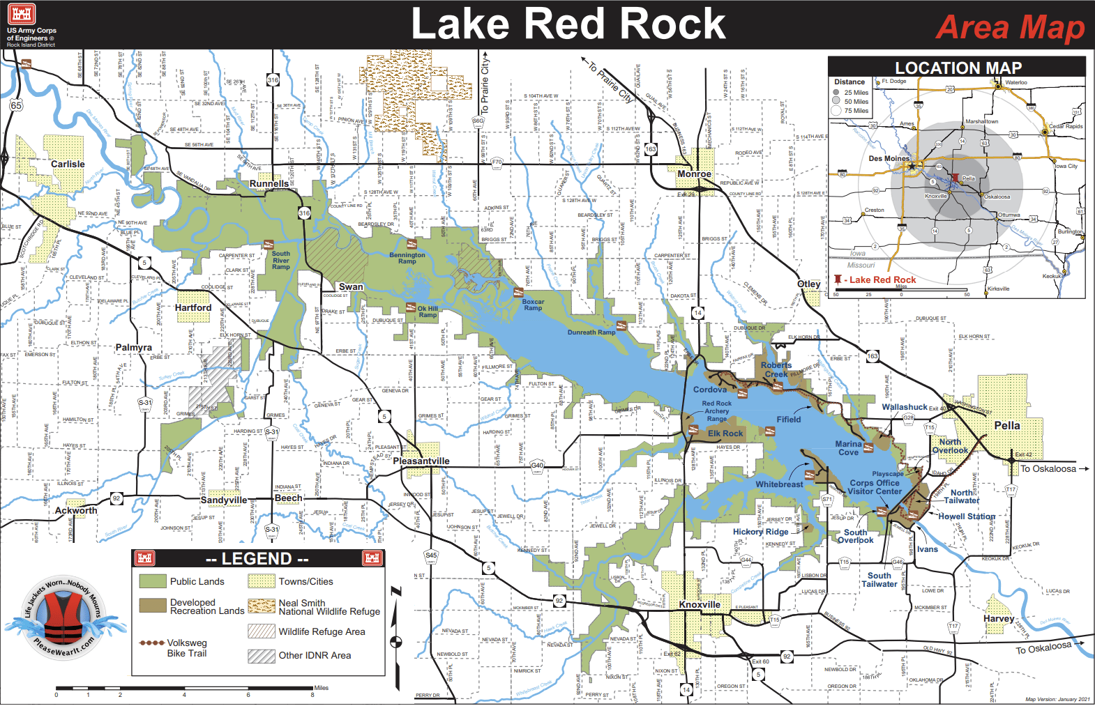
Overview
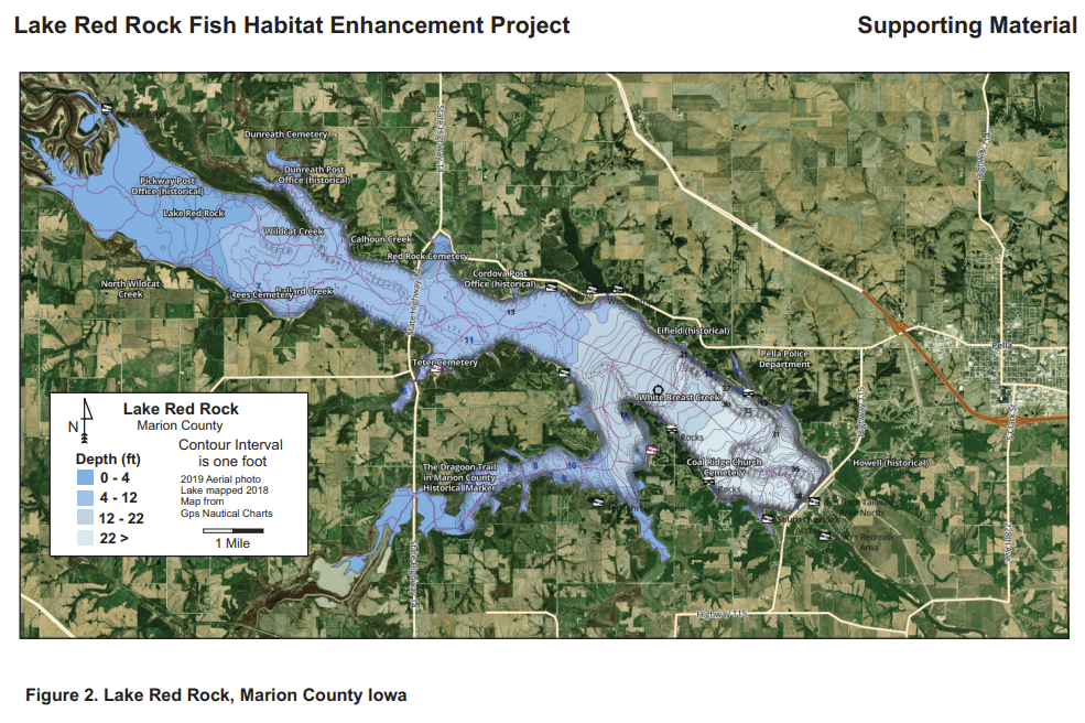
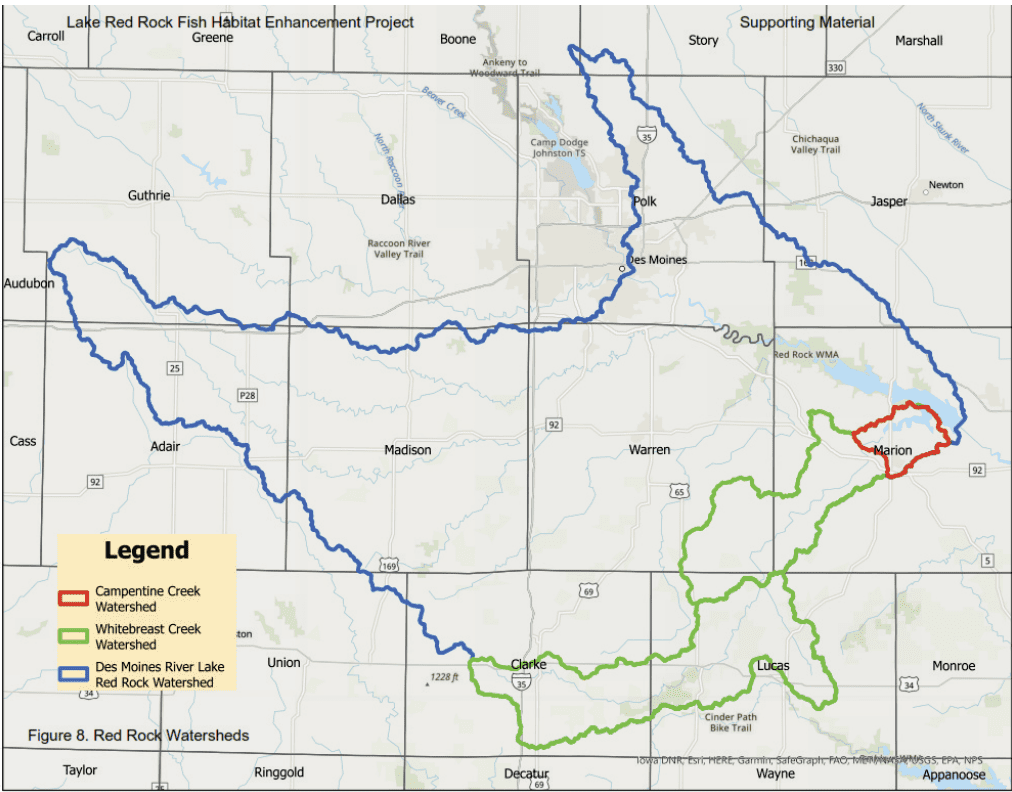
Lake Red Rock is the largest lake in Iowa with a surface area of 15,250 acres at conservation pool. The lake lacks adequate littoral structure. The project will increase structural habitat, improve angler opportunities and enhance the quality of the fishery in Lake Red Rock. The project will provide quality structural habitat for natural spawning, nursery locations for young fish, congregation areas for forage fish and feeding opportunities for predator fish. The project will place 42 Mossback Essential Shallow Water Bundles, 20 Mossback Essential Deep Water Bundles, 22 Mossback Basic Shoreline Bundles, 14 Mossback Mega Reef structures. In addition, there will be placement of 30 Cedar Trees Adjacent to the newly treated USACE shoreline riprap stabilization project.
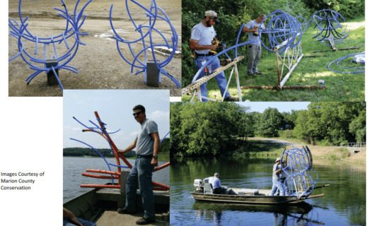
Photo Gallery
What FOR Is Doing
The habitat project is being implemented to improve degraded or nonexistent littoral structure in Lake Red Rock to bolster the fishery and increase angler success. The objectives of the project are to provide quality fish habitat in Lake Red Rock that will promote natural spawning, provide nursery habitat for fry and fingerlings, allow for congregation of forage fish and opportunities for predatory fish.
To accomplish the goals of the plan, artificial fabricated fish structures (Mossback) in conjunction with natural materials, where feasible, will be placed in areas that will best promote the objectives of the project. Depth, shoreline composition, susceptibility to shoreline erosion from wave action and safety for other water recreationist will be scrutinized prior to placement of new habitat structures. The enhancement project will benefit any fish species that utilize physical structure, which include Largemouth Bass, Crappie and Bluegill. All three of these species are sought after by Lake Red Rock anglers. Channel Catfish will also benefit from the new structures, as will Walleye and White Bass to a lesser degree, primarily as nursery cover to facilitate growth until migrating to more open water areas.
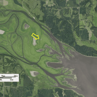
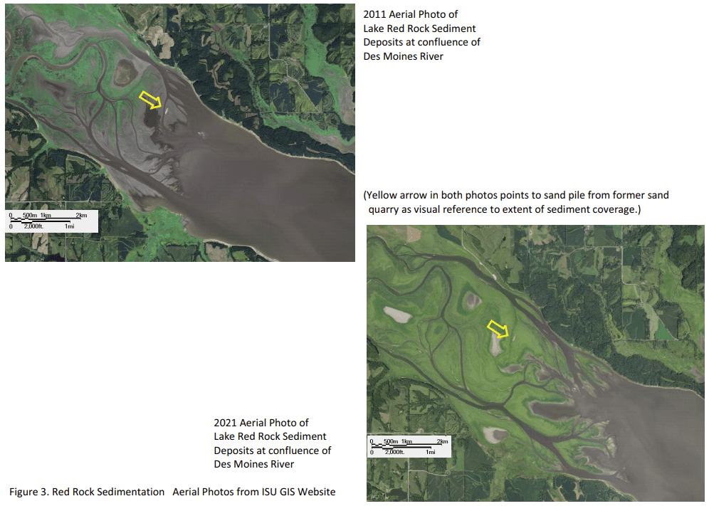
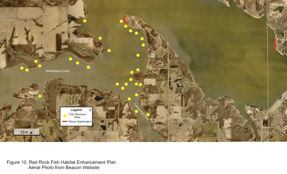
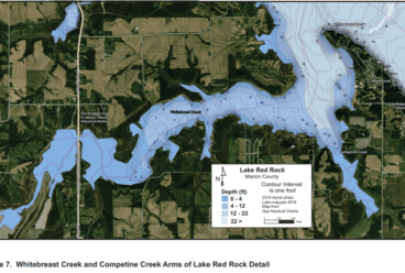
As an additional benefit to the project, the ACOE will be completing an already scheduled riprap project, doing two sections of shoreline stabilization with riprap in spring of 2023. One of the shoreline areas will be within the targeted area of the fish habitat enhancement project on an area referred to as Whitebreast Point and the other will be the T’Lam section (Figure 10.). 5400 tons of shot rock base and 10,500 tons of riprap will be used to stabilize a length of 1046 feet by 60 feet of shoreline in the T’Lam section; 3220 tons of shot rock base and 2200 tons of riprap will be used to stabilize a length of 350 feet by 60 feet of shoreline in the Whitebreast Point section, total combined cost for both sections will be $1,956,000.
Monitoring Plan
Red Rock Lake Association members and USACE personnel will conduct angler interviews in 2023 and prior to deployment of new fish habitat structures in 2024, with technical advice from Iowa DNR Fisheries Bureau. Data from these interviews will be compared to data from subsequent surveys after the introduction of new habitat. This data will allow for comparison of angler catch success, locations of success and satisfaction of success and see if these align with the placement of new fish structures. This information combined with the Iowa Lakes Survey, which is conducted every five years, should enable a better calculation of visitation and economic impact. IDNR staff will utilize sonar mapping to assist in providing accurate descriptions of new habitat locations and monitor any changes in habitat quality. IDNR staff will provide comprehensive fish sampling using electrofishing and hoop nets to survey all species present for two years, plus data analysis.
The Corp of Engineers (USACE) will continue to analyze data from the Adaptive Management and Monitoring Plan (AMMP) that evaluates the response of fisheries and mussel resources to the operation of the Lake Red Rock dam. Current and new Sustainable Rivers Program initiatives will be evaluated to gauge the state of the reservoir water quality, denitrification and recreational use.
Outreach Plan
The Red Rock Lake Association membership will enlist and coordinate volunteers in conjunction with an already established USACE volunteer program. Companies associated with the foundation partners will be encouraged to provide teams of employees to assist with components of the project. The opportunities to be involved will be primarily with the assembly and deployment of the fish habitat structures for which the requested funding is being utilized. Awareness of, and recruitment of volunteers for the Lake Red Rock Fish Habitat Enhancement Project will be shared by in person contacts, on the RRLA website and Facebook page, on the Lake Red Rock USACE Facebook page and displays at the Visitor Center, on the Marion County Conservation Facebook page and through informational packets created for local media sources (Figure 15. Illustration of a display for a previous small grant project). Progress throughout the course of implementing the project will be updated on RRLA, USACE and MCCB social media outlets. The RRLA firmly believes that involving community members in the success of this project will lead to more engagement and ownership of recreational needs and improvements in and adjacent to Lake Red Rock.
Once implemented, narratives and detailed maps (Figure 15.) regarding the project will be uploaded to the RRLA and Lake Red Rock USACE websites. Signage and/or displays of the project will be posted at boat ramps, recreation area bulletin boards and at the Lake Red Rock Visitor Center. The Red Rock Lake Association will continue to locate suitable sites for more fish habitat enhancement and continue to also seek additional partners and funding for future projects.
Related News
Lake Red Rock Gains Permanent Fish Cover, Ecosystem Support
Lake Red Rock recently received a boost to its fish habitat through a collaborative effort between the U.S. Army Corps of Engineers, the Lake Red Rock Association, the Iowa Department […]
Five FY2024 Large Grants Approved by US Fish and Wildlife Service
Congratulations to five of our members for receiving a 2024 Large Grant for fish habitat work in reservoirs! As you know, the approval and fund allocation process can be long, […]
FY2024 Projects Submitted to Secretary of Interior
We happy to announce that seven FY2024 grants from Friends of Reservoirs members were submitted as part of the package to the Secretary of Interior! Expansion of North Carolina Wildlife […]
Green Sponsors
Gold Sponsors
Silver Sponsors
- Iowa Department of Natural Resources
- Marion County Conservation
- Central College Angling Club
- U.S. Army Corps of Engineers