Three-Mile Lake Restoration Project
Iowa Department of Natural Resources
Three-Mile Lake is an 880-acre multi-purpose reservoir located in rural southern Iowa (Figure 1). The lake was constructed in 1995 with a main focus of providing public drinking water to 30 towns and over 13,000 rural water customers. In addition to a public water supply source, the lake offers many recreational opportunities including sailing, powerboating, water skiing, and no-wake areas for fishing. The lake is surrounded by hundreds of acres of wildlife management areas for public hunting and wildlife viewing. The Union County Conservation Board manages a portion of the public land around the lake and provides amenities such as a full-service campground, primitive campground, rental cabins, event lodge, swimming beach, and playground areas providing year-round recreational opportunities. Current Habitat Issues Three-Mile Lake’s 23,730 acre watershed stretches across two rural southern Iowa counties, Adair County and Union County. Similar to other Iowa reservoirs, Three-Mile Lake is nestled within a highly …
Pymatuning Shoreline Stabilization and Fish Habitat Project
Pymatuning Lake Association
Pymatuning Reservoir is the largest impoundment in Pennsylvania at 17,088 acres. With 70 miles of shoreline along the reservoir, PA DCNR is responsible for maintaining over 42 miles. The reservoir was built on what used to be the largest swamp in Pennsylvania and the former wetland soils are prone to erosion. Pymatuning Dam was completed in 1934 and as the lake continues to age, many miles are in need of stabilization to prevent loss of land, safe visitor access, loss of fish habitat, and water quality degradation with the potential of increasing harmful algal blooms. Overall Pymatuning is a fairly shallow lake averaging around 17 feet in depth and as soils continue to slump, areas are being lost for recreation. Jamestown Campground is a public State Park Campground in Pymatuning State Park with 318 campsites. 900 feet of shoreline within the campground is severely eroding away leading to degradation of …
McFarland Lake Restoration
Story County Conservation
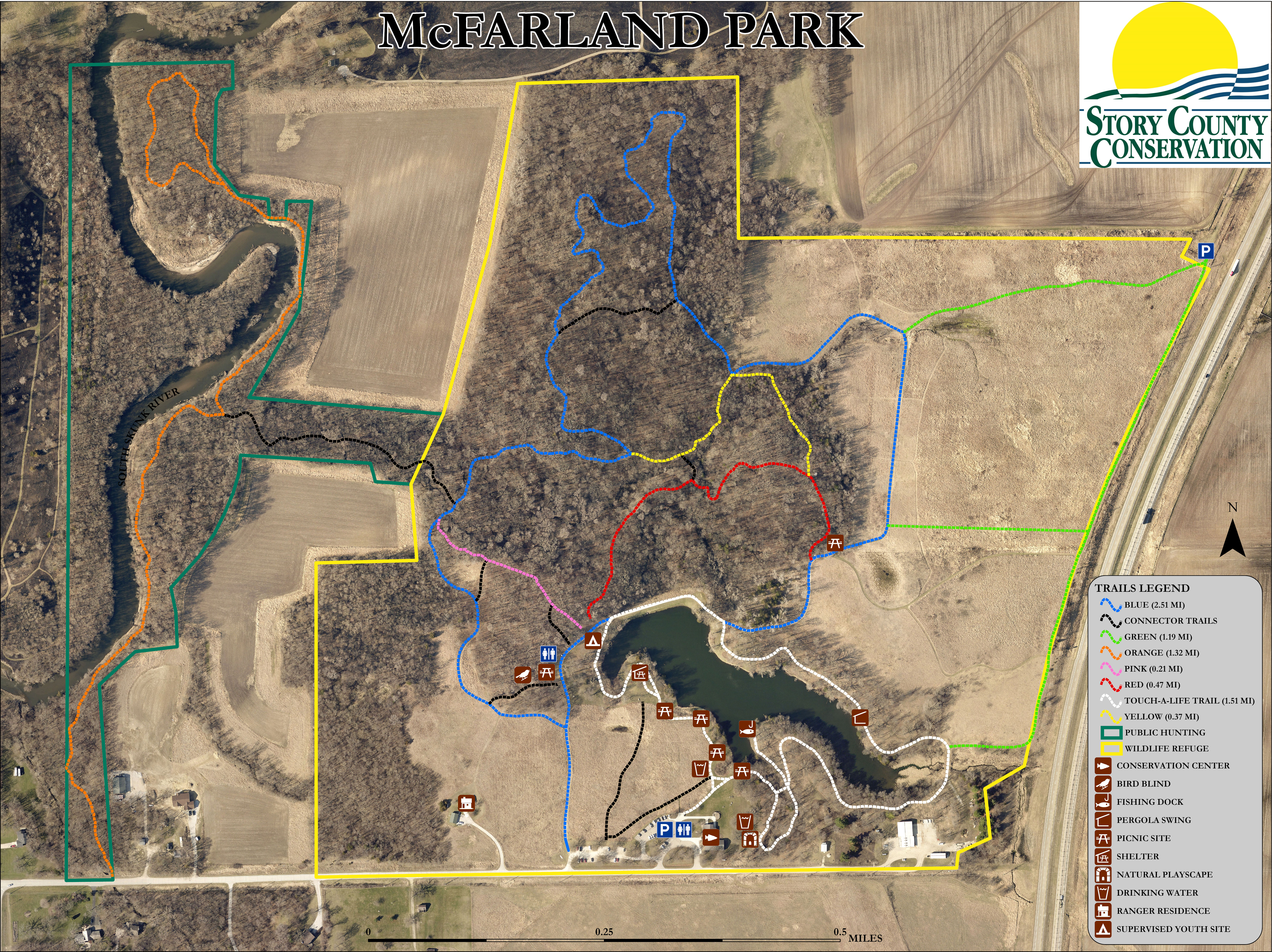
This lake was constructed in 1947 and raised in 1966 but has had no major renovation since then. There is no identified creek which leads into this lake, only one Story County Drainage District tile and two Iowa Department of Transportation tile fed box culverts that drain into the lake. McFarland Park (Lake) sees high traffic as this park sits 4 miles from the City of Ames, home of Iowa State University (ISU). ISU classes and students often participate in outdoor studies as well as recreation at this high use park. McFarland Park is also home to operations for Story County Conservation (SCC) and houses numerous public and school programs as well as nature camps at this location. McFarland Park also has over 8 miles of forest and prairie trails (with wayfinding signage) and a 1.25-mile handicap accessible paved trail around the lake, known as the Touch-A-Life Trail (TAL). This …
Rend Lake Fish Habitat Development and Shoreline Protection / Restoration Project
Rend Lake USACE
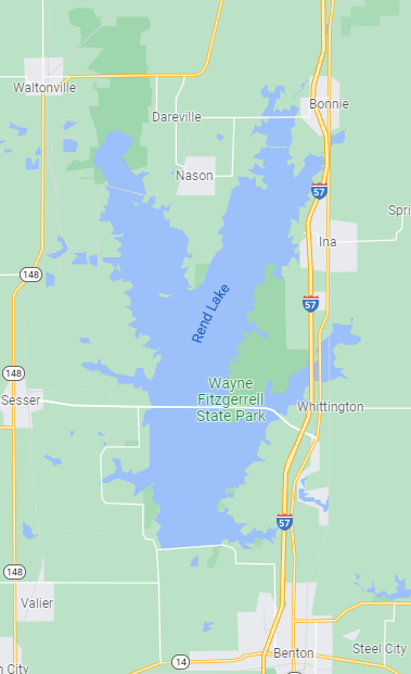
Rend Lake is a U.S. Army Corps of Engineers (USACE) reservoir located in Jefferson and Franklin Counties of southern Illinois. The Rend Lake dam is located on the Big Muddy River, 103.7 miles upstream from in confluence with the Mississippi River. At normal pool (405.0 feet), Rend Lake has a surface area of 20,633 acres, a maximum depth of 35 feet, and a mean depth of 10 feet. The lake is thirteen miles long and three miles wide, and has 162 miles of shoreline. It is the second largest impoundment in Illinois. The Rend Lake project contains 53 recreation areas, with 756 campsites, 104 picnic sites, 30 boat ramps, 235 marina slips, and over 34 miles of trails. Nearly 2 million people visit Rend Lake annually, generating on average $35M in visitor spending within 30-miles of the project. Rend Lake's missions include flood risk management, water supply, water quality, fish …
Lake Shelbyville Fish Habitat Development and Restoration Project
Lake Shelbyville Fish Habitat Alliance
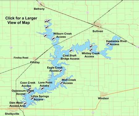
Excerpt from the USACE 2017 Master Plan: “Lake Shelbyville is located in Shelby and Moultrie Counties of east-central Illinois. The dam site is located on the Kaskaskia River about one-half mile east of Shelbyville, Illinois. Much of the land in the Lake Shelbyville watershed is flat or gently sloping. However, the many small tributaries entering the river above the dam site have created ravines and valleys to form a very irregular shoreline. Many coves, both large and small, can be found as a result. The lake is confined by relatively abrupt slopes and has many timbered arms with 172 miles of shoreline. The abrupt slopes and the erodible soils have resulted in shoreline erosion impacting project facilities. The topography changes from a streambed elevation of about 535 feet NGVD to an elevation of 650 to 660 feet NGVD at the bordering uplands. Most of the valley slopes are covered with …
Farms and Fish: utilizing water-saving technology to improve sport fish habitat, water quality, climate adaptation, and economic opportunity for Island Park Reservoir and the Henry’s Fork of the Snake River, Idaho
Henry's Fork Foundation
Project overview Introduction Excessive annual drawdowns negatively affect water quality and fish habitat in Island Park Reservoir (44.418996° N, 111.396496 W°, Fremont County, Idaho, in the Western Mountain ecoregion, Figure 1) which is managed by the US Bureau of Reclamation to meet downstream irrigation water needs. In 2021, the Henry’s Fork Foundation used a grant from Friends of Reservoirs and the Reservoir Fish Habitat Partnership (RFHP) to prove the efficacy of irrigation efficiency and precision management projects as a best management practice for improving fish refuge habitat in Island Park Reservoir. The Henry’s Fork Foundation found extreme water level fluctuations reduce thermal refugia for coldwater sportfish such as kokanee salmon (Figure 2), thereby reducing kokanee salmon populations (Figure 3), decoupling nutrient cycling between Island Park Reservoir and its tributaries via migratory fish that rely on thermal refugia (Figure 4), and accelerating reservoir “aging” via increased sedimentation and eutrophication (Figure 5). …


